Things To Do
Visiting Tangoio Falls: Walk Status, Track Access, and Practical Advice
Updated 29 October 2026

When planning outdoor adventures in Hawke's Bay, the lush native bush corridors north of Napier are naturally among the first places walkers look towards. In particular, the sheltered gullies of Tangoio Falls Scenic Reserve have long offered visitors a rewarding combination of cascading water, native forest canopies, and accessible walking tracks. However, for anyone researching an upcoming outing along State Highway 2, an important practical question has become increasingly urgent: is the Tangoio Falls walk currently open, or has it been closed?
Preparing for outdoor trails anywhere on the East Coast requires a sensible balance of enthusiasm and up-to-date regional awareness. Changing ground conditions, severe storm impacts, and routine track repairs can alter trail access unexpectedly. If you are wondering whether you can lace up your walking shoes and head straight into the reserve today, the reality is that official sources require a careful check before you leave town. In this guide, I will walk you through the current access alerts, explain how to verify whether tracks are open or closed, break down the individual trail profiles across the reserve, and share practical planning advice to ensure your journey goes smoothly.
Checking Current Track Status: Is Tangoio Falls Open or Closed?
If you have spent any time searching regional hiking boards or travel websites, you may have noticed seemingly conflicting information regarding the reserve's status. While general reference profiles from the Department of Conservation (DOC) describe the standard walking trails and scenery of the reserve, Hawke's Bay Tourism's official regional trails directory clearly lists both Tangoio Falls - CLOSED and Te Ana Falls - CLOSED. This formal closure notice on the regional network listing indicates that normal public access along these tracks cannot be taken for granted.
Why do these discrepancies appear online? Official conservation listings frequently keep standard track descriptions live as permanent informational records of public conservation land, whereas regional council and tourism directories issue active alerts to reflect on-the-ground trail stability, storm damage, or bridge repairs. Because catchment conditions along forest streams can evolve quickly, an entry on an active regional status list reflects current trail advisories. Entering closed walking tracks is never advisable; closures are put in place to manage serious public safety hazards, prevent further erosion, or allow fragile native ecosystems and infrastructure to recover without disturbance.
Before you set off north from Napier or Hastings, your primary task is to confirm whether the status has transitioned from closed to open. I strongly advise checking the latest trail alerts directly through the Department of Conservation Tangoio Falls Scenic Reserve tracks directory and cross-referencing with Hawke's Bay Tourism's walking and hiking directory. Furthermore, speaking directly with local staff can save you a wasted journey; calling into the Napier isite Visitor Information Centre on Marine Parade is one of the most effective ways to verify trail access before hitting the highway.
Overview of the Walking Tracks within the Reserve
To appreciate why this reserve is such a valued asset in the Hawke's Bay walking landscape, it helps to look at its natural geography and network layout. Situated roughly 27 km north of Napier alongside State Highway 2, the reserve protects a thriving catchment of native bush, deep stream valleys, and mixed forest plantations. Within this single pocket of public land, walkers have traditionally enjoyed three distinct tracks, each presenting its own character, walking duration, and physical profile:
- Te Ana Falls Track: A gentle, family-oriented stream walk leading straight to the base of an enclosed waterfall pool.
- Tangoio Falls Track: An extended route that branches off the lower trail, climbing through bush to an elevated vantage point above the reserve's tallest waterfall.
- Tangoio Walkway: A longer, more rugged tramping route connecting different trailheads across forest, open grassland, and exotic timber plantings.
Whether you have 30 minutes to stretch your legs on a road trip or two hours to explore diverse forest ridges, the reserve offers varied walking options within a relatively compact geographical area.
Detailed Route Profiles: Te Ana Falls and Tangoio Falls
For most visitors, the primary attraction of the reserve lies in the two waterfalls hidden along the lower valley floor. Under standard, fully open conditions, both walks share a common starting point at the main Tangoio Falls car park situated along State Highway 2.
1. Te Ana Falls Walk (2 km return, approximately 30 minutes)
The trail to Te Ana Falls is generally regarded as one of northern Hawke's Bay's most accessible bush walks, making it especially suitable for family groups and walkers of modest fitness. Departing from the main parking area, the track follows the gentle meanderings of Kareaara Stream beneath a dense native canopy. The gentle sound of running water accompanies you the entire way, creating a peaceful, immersive atmosphere.
Covering an easy 2 km return distance, the walk takes approximately 30 minutes at a steady, relaxed pace. The path brings you directly into the natural amphitheater of Te Ana Falls, where water cascades gracefully into a broad, shallow pool. In warm, settled weather, this pool area has historically been a wonderful spot where children can enjoy a shallow splash along the water's edge. While walking along the stream banks, take time to peer into the clear, slow-moving pools: Kareaara Stream is known to support healthy populations of native freshwater crayfish, or kōura. Spotting a kōura resting among shaded river stones is a delightful natural encounter along this shaded bush path.
2. Tangoio Falls Walk (4 km return, approximately 60 minutes)
If you want to view the taller, namesake cascade of the reserve, you simply build upon the walk to Te Ana Falls. Near the waterfall junction, the track diverges and begins an uphill climb deeper into the native bush. Continuing uphill along the marked trail for an additional 15 minutes beyond Te Ana brings you to the dedicated lookout point for Tangoio Falls.
In total, completing the Tangoio Falls walk requires 4 km of return walking and takes about 60 minutes. While the lower section along Kareaara Stream is largely flat and well-graded, the final 15-minute uphill push introduces steeper gradients, exposed tree roots, and uneven steps. The climb is well rewarded: the viewing platform offers a commanding, elevated view across the forested gully, showcasing the long plume of water cutting down through the rocky cliff face. Visiting both waterfalls on a single journey provides a satisfying combination of an intimate, enclosed pool setting and an expansive, elevated cascade view.
Tackling the Longer Trail: The Tangoio Walkway
For visitors seeking a heartier tramp rather than a short waterfall stroll, the Tangoio Walkway offers a much more extensive excursion. Covering 4.4 km one-way, this track takes roughly 2 hours to walk and exposes hikers to an intriguing transition of native forest, steep rural hills, and production forestry landscapes.
Access Points and Trailhead Safety
The Tangoio Walkway features two distinct access points along State Highway 2, allowing walkers to approach the journey from either end:
- Southern Trailhead: Located at the southern picnic and parking areas within the main Tangoio Falls Scenic Reserve.
- Northern Trailhead: Located opposite the White Pine Bush Scenic Reserve car park further north along the highway.
If you choose to begin your journey at the northern trailhead, exercising caution is vital. Walkers parking at the White Pine car park must cross State Highway 2 on foot to reach the start of the track. Because this section of highway carries high-speed regional and freight traffic, sightlines around road bends can be limited. Stop, listen carefully, and cross only when the road is completely clear in both directions.
Forest Environments and Early Summer Orchids
What distinguishes the Tangoio Walkway from the sheltered waterfall tracks is its extraordinary variety of forest canopy. Rather than remaining enclosed along the stream floor, the walkway climbs onto ridgelines and through rolling gullies. The path takes you through mature native forest, patches of open hillside grassland, and extensive tracts of both old and new pine plantations intermixed with majestic coast redwoods and other introduced timber species.
This dynamic mix reflects regional soil conservation efforts designed to stabilize the steep, erosion-prone hill country of Hawke's Bay. If you are fortunate enough to walk the trail in early summer, keep a watchful eye along the edges of the native bush and forest clearings. The undergrowth frequently features delicate native orchid flowers in bloom. These small, intricate native blooms are easy to overlook if you move quickly, making a quiet, observant pace well worth the effort.
Terrain, Elevation, and Recommended Walking Direction
Unlike the well-graded lower trails, the Tangoio Walkway is classified as a tramping track, which means the surface is rougher, steeper, and more subject to the elements. The trail features steep sections where footing can be tricky, especially after rain when hillside soil turns slippery. Additionally, the route incorporates an unbridged stream crossing that requires careful balance and sensible foot placement.
To enjoy the best possible walking experience, official guidance recommends walking the walkway from north to south. By starting at the northern trailhead opposite White Pine Bush and walking south towards the main Tangoio Falls picnic area, the overall gradient is almost entirely downhill. Descending in this direction requires far less physical exertion than climbing from the south, though sturdy footwear with good grip remains essential to safely manage the steeper downhill stretches.
Essential Preparation, Weather, and Track Conditions
Preparing thoroughly before venturing onto Hawke's Bay tracks is fundamental to having an enjoyable and safe day out. Regional guidance strongly advises that before setting out—especially on longer adventures—walkers must do their homework regarding what to expect on the trail and from the forecast weather. In steep bush catchments like Tangoio, natural conditions can change rapidly.
Stream Flow and Rain Hazards
The hydrology of Tangoio Falls Scenic Reserve is directly tied to the surrounding hill ranges. Both Kareaara Stream and the tributary crossing on the Tangoio Walkway respond quickly to heavy precipitation. Following intense rain events, water levels can rise swiftly, turning docile, transparent creeks into swollen, murky flows that are unsafe to cross. Wet weather also compromises the steep clay sections of the walkway, creating muddy, slick conditions. Always check regional weather forecasts before departing, and turn back if an unbridged stream appears swift, discolored, or impassable.
Recommended Gear for the Reserve
If trail alerts indicate the tracks are open and clear, bringing the right equipment ensures your comfort and safety across the reserve:
- Supportive Footwear: While light walking shoes may be sufficient for the flat 30-minute track to Te Ana Falls in settled weather, the uphill climb to Tangoio Falls and the full Tangoio Walkway require sturdy walking shoes or tramping boots with dependable rubber tread.
- Hydration and Food: There are no treated water supplies along the tracks. Carry an ample supply of drinking water for your group, particularly during the hot, dry months of summer, alongside high-energy snacks.
- Versatile Clothing Layers: The sheltered gully along Kareaara Stream stays cool and heavily shaded even in high summer, while the open ridges of the Tangoio Walkway are fully exposed to wind and sun. Pack a breathable waterproof or windproof jacket, along with a sun hat and sunscreen.
- Walking Poles: For those tackling the Tangoio Walkway from north to south, a pair of trekking poles can provide invaluable stability when descending steep clay grades and navigating slippery stream rocks.
Getting to Tangoio Falls from Napier
Reaching Tangoio Falls Scenic Reserve from Napier is a straightforward drive. The reserve is situated 27 km north of the city center along State Highway 2. Under normal traffic conditions, the journey takes between 25 and 30 minutes, leading you past the coastal plains of Tangoio before the highway begins to climb into the coastal hills.
The main southern parking and picnic area is clearly signposted on the left side of the road when heading north. This primary car park provides access to the Te Ana Falls Track, the Tangoio Falls Track, and the southern entrance of the Tangoio Walkway. For walkers intending to complete the full walkway from north to south, a second parking area is located slightly further along the highway, directly across from White Pine Bush Scenic Reserve. Because scheduled public transport does not serve this rural highway stretch, visitors require a private vehicle or an arranged drop-off.
Alternative Walks and Waterfalls in Hawke's Bay
If current alerts confirm that Tangoio Falls and Te Ana Falls remain closed during your visit, Hawke's Bay offers a wonderful collection of alternative walking trails and scenic reserves to explore. You can easily redirect your day towards accessible coastal paths, quiet botanical gardens, or other regional waterfall settings.
1. Inland Waterfall Alternatives: Maraetotara Falls
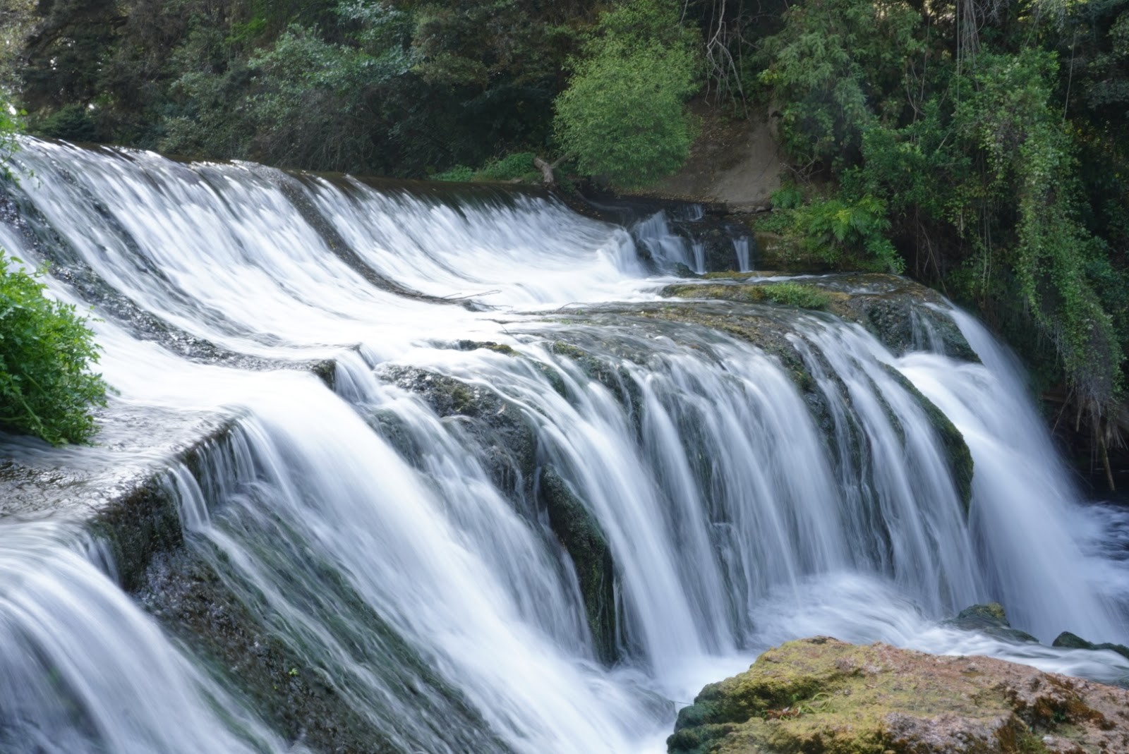
If your heart is set on experiencing a waterfall walk through native bush, heading south toward Havelock North is your best option. Here, you will find Maraetotara Falls, located along Maraetotara Road. This picturesque spot features a short walking track alongside a historic river canal, leading to a charming limestone cascade and a wide, deep freshwater pool surrounded by ferns and native trees. It provides a delightful waterfall alternative when northern tracks are off-limits.
2. Scenic Urban and Coastal Walks Around Napier
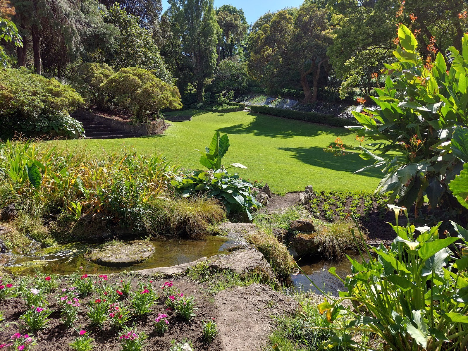
For enjoyable walking routes closer to Napier while you wait for regional track updates, consider these diverse local options:
- Ahuriri Estuary: The Ahuriri Estuary Walking Track off Humber Street takes you along a broad tidal wetland reserve, ideal for birdwatching and gentle, flat walking.
- Dolbel Reserve: Situated in Taradale, Dolbel Reserve features a network of established hillside trails that wind through exotic and native plantings, rewarding walkers with sweeping views across the Heretaunga Plains.
- Napier Botanical Gardens: Nestled on Hospital Hill, the historic paths of the Napier Botanical Gardens offer mature trees, shaded woodland paths, and an aviary within an 18-acre heritage park.
- Coastal Waterfront Strolls: For fresh ocean air, enjoy an open walk along Westshore Beach, or take a leisurely stroll past the shaded lawns and recreational spaces of Foreshore Reserve on Marine Parade.
Trail Comparison at a Glance
When the tracks in Tangoio Falls Scenic Reserve are fully open, choosing the right walk comes down to your group's fitness, available time, and walking goals. Here is how the three reserve tracks compare:
| Track | Distance | Walking Time | Terrain & Grade | Key Highlights |
|---|---|---|---|---|
| Te Ana Falls Track | 2 km return | 30 minutes | Easy, flat walking along stream | Kareaara Stream, stream splashing, kōura (crayfish), waterfall pool |
| Tangoio Falls Track | 4 km return | 60 minutes | Easy lower trail, moderate 15-min climb | Elevated waterfall lookout, dense native bush, hillside views |
| Tangoio Walkway | 4.4 km one-way | 2 hours | Steep tramping track, unbridged stream crossing | Redwoods, pine forest, open grassland, early summer orchids |
Practical Checklist for Planning Your Trip
Before heading north out of Napier, run through this practical checklist to guarantee a safe and smooth outdoor adventure:
- Verify track alerts: Check official Department of Conservation alerts and Hawke's Bay Tourism listings online to ensure the tracks are open.
- Monitor recent rainfall: Postpone your walk if significant rain has fallen across northern Hawke's Bay in the previous 24 to 48 hours, as streams rise rapidly and clay trails become hazardous.
- Plan your route direction: If walking the full Tangoio Walkway, arrange vehicle shuttles so you can walk from north to south, taking advantage of the downhill slope.
- Take care on the highway: Remain alert when pulling in and out of car parks on State Highway 2, and use extreme caution if crossing on foot near White Pine Bush.
- Pack out what you bring: There are no rubbish bins in the reserve; carry all food wrappers, bottles, and waste back with you to keep the catchment pristine.
Taking a few moments to do your homework before setting out ensures that your exploration of Hawke's Bay's bush tracks is rewarding, safe, and perfectly adapted to current trail conditions.
Cover photo: Napier isite Visitor Information Centre
By Alyssa.
Sources and further information
- Tangoio Falls Scenic Reserve tracks: Tutira area, Hawke's Bay region
- Walking & Hiking | Official Hawke's Bay Website | Hawke's Bay Tourism
Sources checked: 2026-10-29.