Things To Do
Te Mata Peak Walking Tracks: Trail Guide and Routes
Updated 19 October 2026
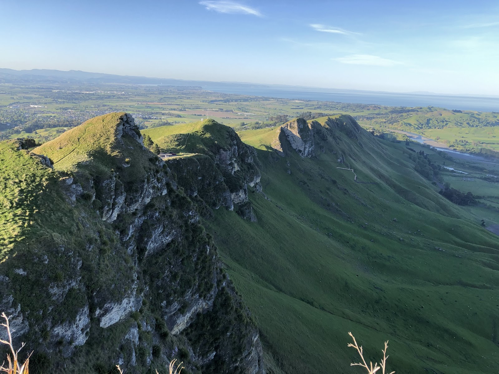
Rising distinctly above the Heretaunga Plains in Havelock North, Te Mata Peak forms one of Hawke's Bay's most recognisable landmarks. Standing at an elevation of 399 metres within a dedicated 99-hectare reserve, the park offers a well-established network of signposted trails that cater to a wide spectrum of abilities. Whether you are looking for a gentle stroll beneath towering trees or a demanding uphill hike along exposed limestone bluffs, understanding the park layout ensures you pick the right track for your fitness level.
Gifted in perpetuity to the community in 1927 and overseen by the Te Mata Park Trust Board, the reserve preserves both natural features and significant local cultural heritage. A series of colour-coded markers and trailhead map boards guide hikers across open farm pastures, native bush plantings, and craggy ridgelines. Before tying your laces and heading out, here is a practical overview of how the trails connect, which paths reach the summit, and where to access the park.
The Colour-Coded Trail Network at Te Mata Park
Navigating Te Mata Park is straightforward thanks to a marked trail system featuring colour-coded routes that depart from the reserve entrances. Each path has distinct physical demands, varying from wide, shaded dirt tracks to narrow single-track trails carved directly into hillside limestone.
For visitors seeking a leisurely outing or walking with young children, the green-marked Pīwakawaka Loop is the easiest option in the network. This gentle 1.3-kilometre circuit takes approximately 40 minutes to complete. The trail weaves comfortably through gum trees and regenerating native bush, offering a quiet, sheltered walk away from steep ridge lines.
If you want a moderate distance without tackling extreme gradients, two mid-length options offer balanced alternatives:
- Big Redwoods Track: A 2.7-kilometre circuit taking around 1 hour to complete, guiding walkers directly through the park's tranquil grove of mature redwood trees.
- Karaka Wander: A 4.0-kilometre route requiring roughly 1 hour and 15 minutes of walking time, providing a solid middle-distance workout that traverses mixed terrain across the lower and middle sections of the park.
Summit Walking Routes: Giant Circuit vs. Rongokako Trail
Reaching the crest of Te Mata Peak on foot is a rewarding challenge. From the highest point, visitors can enjoy expansive, 360-degree panoramas across the Heretaunga Plains, the sweeping bends of the Tukituki River, Craggy Range winery, Cape Kidnappers, and the distant silhouettes of the Ruahine, Kaweka, and Maungaharuru ranges. Only two designated walking tracks in the entire park network climb all the way to the 399-metre summit: the Giant Circuit and the Rongokako Trail.
The Giant Circuit (Red Markers)
The Giant Circuit spans between 5.3 and 5.4 kilometres and is marked throughout by red trail indicators. This comprehensive loop swoops right around the peak, creating a full perimeter journey that takes around 1.5 to 2.5 hours to finish. Hikers begin by traversing native bush and farmland pastures before reaching the historic redwood plantation.
From the valley floor, the character of the track changes dramatically. The path climbs up a series of tight switchbacks against the steep limestone face. Here, the trail becomes narrow, rocky, and quite exposed to steep drops, requiring steady footing and decent cardiovascular fitness. Upon reaching the crest, the circuit guides you along the ridge before descending past the Saddle Lookout and Peak House back toward the main gates.
The Rongokako Trail (Blue Markers)
The Rongokako Trail is a 5.5-kilometre route marked with blue indicators that also leads hikers directly to the 399-metre summit. Typically taking between 1.5 and 2.25 hours, this path takes an undulating, indirect route upward rather than heading in a straight line. It threads past native plantings and climbs through the towering redwood forest before taking on the steeper upper sections of the peak.
Like the Giant Circuit, the higher reaches of the blue track feature narrow ledges and steep, rocky sections that can feel daunting for those uncomfortable with heights. However, it rewards your effort with striking close-up views of fossilised marine shells embedded directly in the ancient limestone trail beds beneath your feet.
The California Redwoods Grove
One of the most distinctive pockets within Te Mata Park is the mature California redwood grove. Planted in 1927, this stand comprises 223 majestic trees that now soar more than 40 metres into the sky. Standing beneath the dense forest canopy provides cool shade during warmer summer days and offers a stark, tranquil contrast to the sun-drenched, open limestone pasture higher up the mountain.
Both the Big Redwoods Track and the summit-bound trails pass through or beside this plantation, making it easy to incorporate into either a relaxed valley stroll or a broader summit loop.
Driving to the Peak Summit
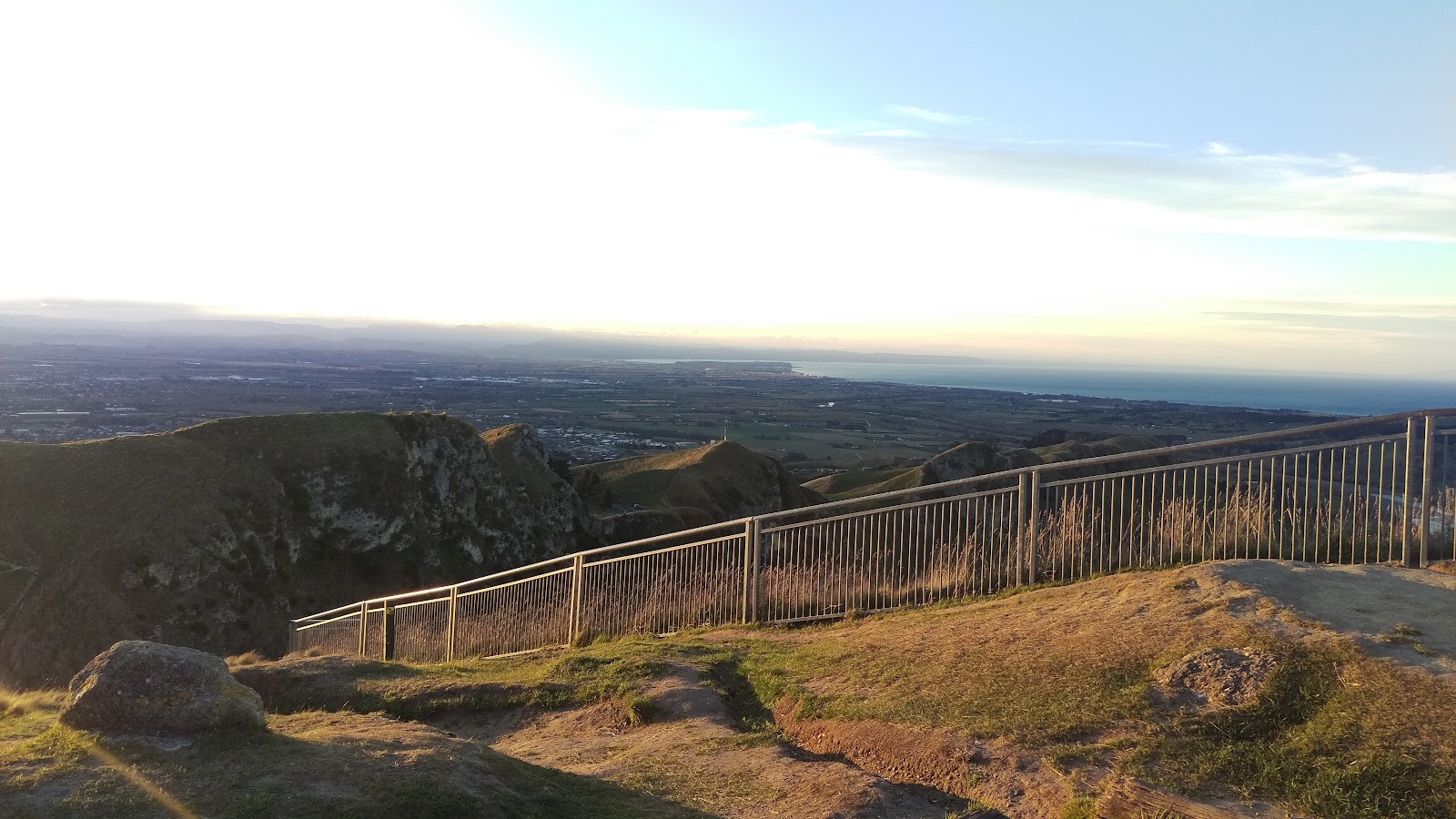
If you are travelling with individuals who cannot undertake the physical exertion of a steep climb, or if you are simply short on time, Te Mata Peak can also be accessed by vehicle. A sealed road winds continuously from the lower reserve entrance up to the crest, travelling past Peak House and the Saddle Lookout along the way. Driving up allows everyone to witness the expansive Hawke's Bay vistas from the top without navigating the rocky switchbacks on foot.
Car Park Access, Facilities, and Trail Preparation
Planning your entry and understanding basic park logistics ensures an easy visit:
- Main Entrances and Parking: Primary access points to the trail system are located off Te Mata Peak Road at the main gates and via the Tauroa Road car park.
- Public Toilets: Restroom facilities are available at both major access points—the main Te Mata Park entrance and the Tauroa Road entrance. There are no facilities along the mid-track sections, so it is wise to stop before setting off.
- Opening and Closure Hours: While pedestrian access is generous, vehicle access is restricted overnight. The main park gates and the upper portion of Te Mata Peak Road are closed to vehicles between 10:00 pm and 5:30 am daily.
- Weather and Track Conditions: The limestone terrain and narrow dirt single-tracks across the park can become very slick and hazardous following rainfall. Sturdy walking footwear with reliable grip is recommended, especially if you plan to tackle the rocky switchbacks of the red or blue routes.
With its blend of accessible native loops, serene redwood groves, and challenging ridge tracks, Te Mata Park provides an exceptional vantage point for discovering Hawke's Bay on foot.
Cover photo: Te Mata Peak - Jonas Yang
By Alyssa.
Sources and further information
- Walking Trails - Te Mata Park Trust
- Te Mata Peak | Hastings District Council
- Te Mata Peak - Giant Circuit Hiking Guide | tobinka
- Hawke's Bay delights - Motorhomes, Caravans & Destinations NZ
- Hawkes Bay's Te Mata Peak Walk - Sarah Sees The World
Sources checked: 2026-10-19.