Things To Do
Visiting Bluff Hill Lookout in Napier: Walks, Views, and Access
Updated 28 October 2026
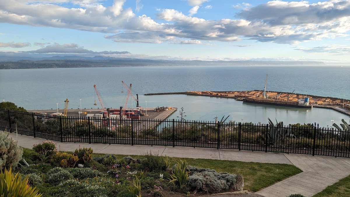
Rising prominently above the curved shoreline of Hawke Bay, the landmark headland of Mataruahou—widely known as Bluff Hill—anchors the northern end of Napier. Whether you are arriving from elsewhere in Hawke's Bay or travelling down from other regions across New Zealand, visiting the Bluff Hill Lookout offers one of the most immediate and satisfying introductions to this coastal city. From the summit, you can look straight down into the working berths and container berths of the Port of Napier, scan across the open Pacific ocean, and trace the sweeping coastline all the way south toward the distinct sandstone headland of Cape Kidnappers.
What makes a visit to this viewpoint so rewarding is its sheer versatility. For walkers who enjoy exploring characterful hillside neighbourhoods, narrow pedestrian staircases, and quiet native reserves, the ascent on foot delivers a genuine physical workout paired with lovely architectural scenery. For those who are short on time, travelling with younger family members, or managing mobility limitations, a well-formed sealed road winds all the way to the top. This practical guide covers both approaches in detail, highlighting step-by-step walking tracks, driving and parking advice, site facilities, and local access guidelines to help you plan your excursion.
The Summit Experience: Views Across Hawke Bay and Napier Port
At the apex of the hill, visitors step out onto an open viewing area that commands an extraordinary vantage point. Mataruahou occupies a commanding geographic position between the open bay and the sheltered inlet of Ahuriri. Standing near the perimeter fence, you are treated to a bird's-eye perspective of the Port of Napier. It is relatively unusual to find a public coastal lookout situated directly above a busy commercial maritime hub. Watching log carriers, container ships, and pilot boats work their way in and out of the harbour against the backdrop of rolling swells provides an engaging, living spectacle.
Turning your eyes further afield, the expansive coastal geography of Hawke's Bay unfolds. Looking south across the water, the prominent cliff face of Cape Kidnappers stands clearly on the horizon on fine days. Northwards, the wide arc of the bay curves toward the horizon. Whether the sea is flat and shimmering under bright morning sunshine or whipped into whitecaps by an ocean breeze, the bluff lookout napier panorama provides an unforgettable snapshot of the local landscape.
The ground beneath the platform carries historical interest of its own. The modern public viewing terrace was built directly over a World War II coastal defence gun emplacement. During the Pacific conflict, gun batteries and coastal fortifications were constructed at key New Zealand harbours to protect essential shipping infrastructure and coastal transport corridors. At Bluff Hill, military planners took full advantage of the sheer elevation and unobstructed maritime sightlines. While the artillery has long been removed, the reinforced concrete foundations remain intact, serving today as the steady platform from which travellers quietly soak in the peaceful coastal scenery.
Bluff Hill Lookout Height, Distance, and Elevation Profile
Before pulling on your walking shoes, it helps to know what the bluff hill lookout height and trail terrain demand. The summit stands at approximately 145 metres above sea level. Because the walking routes start right along Marine Parade near the shoreline, you gain that entire 145 metres over a relatively short distance, resulting in a brisk, quad-burning workout.
The standard walking loop covers a distance of roughly 4.4 kilometres. Most walkers complete the full circuit in about 50 minutes to 1 hour and 20 minutes, depending on personal fitness and how frequently they pause to admire the views. Regional guides classify this as a relatively hard walk on account of several long stairways, sustained gradients, and uneven bush paths.
Because the walking tracks incorporate steep outdoor stairways, pedestrian ramps, and narrow woodland trails through native gullies, the route is not suitable for wheelchairs or strollers, and mountain bikes are not permitted. If you are exploring on foot, you should expect a sustained physical climb that quickly leaves the flat coastal promenade behind.
The Classic Walking Route: Via Coote Road and Sturm's Gully
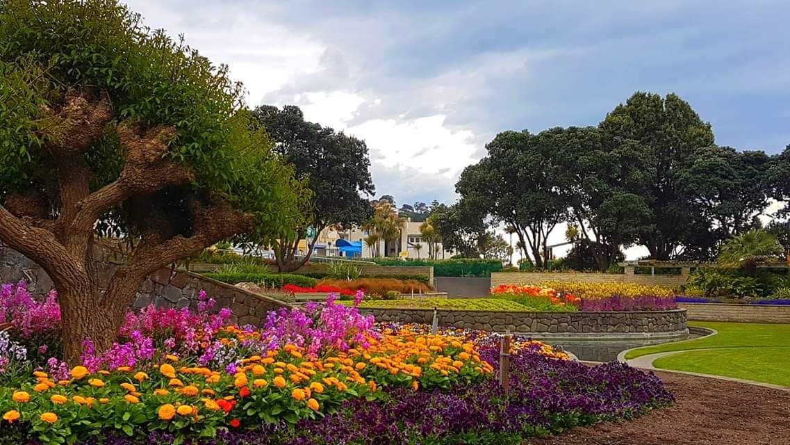
The most widely walked route to the bluff hill napier lookout begins on Marine Parade and winds its way up through quiet historic streets before entering the shaded canopy of Sturm's Gully. Here is the step-by-step progression for following this classic track:
Stage 1: Marine Parade to Coote Road
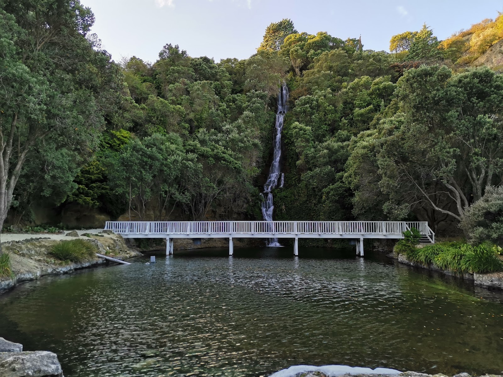
Start your walk along the northern end of Marine Parade, heading north past the Ocean Spa complex. Just beyond the pools, turn left onto Coote Road. As the road begins its initial gentle climb away from the sea, look to your right to find the Centennial Garden & Waterfall at 54 Coote Road. Nestled beneath sheer limestone cliff faces, these landscaped grounds feature ornamental gardens and a cascading waterfall. Taking a brief moment to wander into the garden makes for a tranquil beginning before tackling the steeper gradients above.
Stage 2: Climbing Priestley Road to Lighthouse Road
Continue up Coote Road and turn into Priestley Road. Here the climb begins in earnest as the street angles upwards between established hillside homes. Follow Priestley Road to the pedestrian ramp, which climbs up to connect directly with Priestley Terrace. From the top of the ramp, turn right onto Lighthouse Road, which forms the main residential artery climbing toward the summit crest.
Stage 3: Entering Karetoki Whare (Sturm's Gully) Reserve
Walk a short distance uphill along Lighthouse Road, keeping an eye on the left-hand side of the road. Just before Lighthouse Road sweeps through a tight U-turn, you will see a clearly marked white picket gate. This gate serves as the public entrance to Karetoki Whare (Sturm's Gully) Reserve. If you find yourself walking past a bowling club on your right-hand side, you have gone slightly too far down the road; however, Lighthouse Road itself continues to the summit anyway.
Go through the white picket gate and follow the track into the native greenery of the gully. A short distance inside the reserve, look for a flight of steps and a walking path branching off to your right. Follow this track as it climbs through the trees, eventually leading you directly onto the open grounds and viewing deck of Bluff Hill Lookout.
Alternative Walking Route: Laneways, Villas, and Clyde Road
If you enjoy discovering tucked-away urban shortcuts and grand historic architecture, an alternative walking route climbs the hill via residential laneways and flights of hillside stairs. This variant highlights the unique suburban character of Bluff Hill, where timber villas and established gardens cling to steep terraces above the bay.
Stage 1: Seaview Terrace Steps and Brewster Street
Begin directly opposite the Ocean Spa complex on Marine Parade. Cross the road to locate the Seaview Terrace steps. This direct, steep flight of stairs climbs immediately from sea level, offering quick elevation gain. At the top of the steps, turn right onto Brewster Street.
Stage 2: Zigzagging to Clyde and Gladstone Roads
Along Brewster Street, keep an eye out for a narrow public path zigzagging uphill. Follow this pathway to emerge onto Clyde Road, where you can take in lovely views across the water between character homes. Continue climbing upward until you connect with Gladstone Road.
Stage 3: Steps to Thompson Road and Lighthouse Road
Head up Gladstone Road until you reach a distinct left-hand dogleg in the street. Just past this bend, take the flight of public steps on your right. These lead you up to Coote Road; turn right and immediately link onto Thompson Road.
Follow Thompson Road as it skirts the upper hillside, keeping the prominent water tower and storage tanks on your left. From Thompson Road, turn right onto Lighthouse Road and continue onward to the Karetoki Whare Reserve entrance, taking the bush steps up to the summit platform.
Completing the Circuit: Hornsey Road, the Port, and Ahuriri
Rather than retracing your steps back down through the residential laneways, you can complete a very satisfying loop walk that takes you down the seaward face of the hill and along the harbour edge.
Descending to Hornsey Road and Breakwater Road
From the main lookout terrace, walk across the open grass slope on the northern edge of the domain to locate the descending pedestrian track. This well-trodden pathway leads downhill through the reserve trees, eventually levelling off and exiting onto Hornsey Road above the port.
Walk down Hornsey Road until it meets Breakwater Road right at the base of the hill, alongside the port entrance. From this junction, you have two appealing options depending on your schedule and remaining energy:
- Return to Town: Turn right onto Breakwater Road. The flat footpath follows the harbour edge directly past the Port of Napier, carrying you smoothly around the shoreline back to Ocean Spa and the start of Marine Parade.
- Detour to Ahuriri: Turn left onto Breakwater Road instead. The coastal footpath leads around the seaside toward the historic suburb of Ahuriri. Once a bustling commercial fishing port, Ahuriri retains its seaside village charm and is packed with bustling cafes, restaurants, and waterfront pubs. It is a fantastic destination to stop for lunch or a drink before heading back.
If you would like a detailed trail map or additional background on the historic homes scattered across Napier Hill and Ahuriri, printed route maps and heritage brochures are available from the Napier isite Visitor Centre in town.
Driving Directions and Summit Parking
Walking is a wonderful way to experience the hill, but driving to the summit is straightforward and ideal if you are tight on time or travelling with companions who cannot manage steep staircases.
How to Drive Up
Vehicular access to the lookout summit is via Lighthouse Road. From downtown Napier, you can drive up via Coote Road or Shakespeare Road, following residential connections onto Lighthouse Road. The road winds upward through quiet neighbourhoods, featuring some narrow sections and tight curves. Drivers should take their time and keep an eye out for walkers navigating the roadside edges.
Bluff Hill Lookout Parking
At the end of Lighthouse Road, drivers arrive at the dedicated bluff hill lookout parking area. The summit carpark is sizable, offering plenty of space right beside the reserve grounds. Because the parking bays sit adjacent to the viewing deck, visitors arriving by vehicle only need to walk a few flat metres across the grass to reach the safety railings.
Public toilet facilities are located right at the lookout carpark, making the site practical and comfortable for extended stops. You will also find interpretive plaques and rubbish bins scattered around the domain.
Understanding Bluff Hill Lookout Hours and Domain Access
When planning your trip, considering bluff hill lookout hours helps ensure a seamless visit. Pedestrian access through the reserves and public stairways is open during daylight hours, making it easy to visit on foot for morning exercise or an evening stroll.
For drivers, however, vehicular entry into the summit carpark at the end of Lighthouse Road is controlled by entrance gates. Operating schedules can shift depending on municipal management and seasonal daylight variations. Specific gate lock and unlock times are not posted on regional tourism websites, so motorists planning an early sunrise mission or a late evening visit should check the posted signage at the vehicle gate upon arrival. If visiting near dusk, be mindful of any listed closing hours so your vehicle is not locked inside the carpark overnight.
Visitor Rules, Dogs, and Trail Accessibility
Bluff Hill is both a treasured municipal reserve and a peaceful residential neighbourhood. Keeping the following practical rules in mind ensures everyone enjoys the space:
- Dog Regulations: Dogs are welcome on the walking route, but they must remain strictly on a lead or leash at all times. This keeps native birds safe in Karetoki Whare Reserve and respects other walkers on narrow staircases.
- No Mountain Biking: The trails winding through Sturm's Gully and connecting the residential steps are reserved strictly for pedestrian use. Mountain bikes are not permitted on the walking tracks.
- Wheelchair Access: Due to steep terrain, extended flights of concrete steps, and uneven dirt tracks, the walking trail is not accessible for wheelchairs or pushchairs. However, visitors requiring step-free access can drive up Lighthouse Road to the summit carpark, where the flat viewing area can be enjoyed without stairs.
- Neighbourhood Courtesy: Because several track segments pass close to private properties and gardens, visitors should keep noise to a respectful level, especially during early morning walks.
Comparing Your Visit Options: Walking vs. Driving
To help you choose the best way to explore Mataruahou based on your group's preferences, here is a quick side-by-side comparison:
| Feature | Walking Route (Classic Loop) | Driving Option |
|---|---|---|
| Starting Point | Marine Parade (near Ocean Spa) | Napier CBD or Marine Parade |
| Route Taken | Coote Rd, Priestley Rd, Sturm's Gully | Lighthouse Road |
| Total Distance | Approx. 4.4 km circuit | Approx. 3 km each way by car |
| Time Required | 50 minutes to 1 hour 20 minutes | 5 to 10 minutes drive each way |
| Elevation Climbed | 145 metres on foot | 145 metres by vehicle |
| Difficulty Level | Moderate to hard (steep staircases) | Easy (sealed roads and level parking) |
| Wheelchair Accessible | No (stairs and bush tracks) | Yes (accessible at summit platform) |
| Key Highlights | Historic villas, waterfall, bushwalk | Effortless climb, quick summit access |
Practical Tips: Weather, Clothing, and Timing
Because the lookout perches on an exposed headland elevated above Hawke Bay, local weather can shape your visit. Hawke's Bay is well known for warm, sunny conditions, but ocean winds can be brisk at the summit.
Early morning is often one of the best times to visit. Winds are typically lighter, the water across Hawke Bay is calm, and morning light illuminates the working port below. If you are climbing the hill on foot during the warmer summer months, starting before the heat of midday makes the steep uphill climbs considerably more pleasant.
Late afternoon brings soft golden light over the surrounding hills and water, though the temperature can drop quickly once the sun dips behind the ridge. Even on warm days, keeping a windbreaker or light layer in your daypack is a sensible idea. Sturdy walking shoes or trainers with dependable tread are recommended for walkers, as the steps and bush paths through Sturm's Gully can become slick after rain.
Remember that drinking water is not readily available along the residential staircases, so carrying a refillable water bottle is wise, especially during the 145-metre climb. With the summit's combination of historical fortifications, expansive ocean vistas, and fascinating port operations, Bluff Hill Lookout remains one of the absolute highlights of any stay in Napier.
Cover photo: Bluff Hill Lookout - Adam Moody
By Alyssa.
Sources and further information
Sources checked: 2026-10-28.